Automatic detection of permanent green areas
Summary
The Army Geospatial Information Center (CIGeoE) maps the national territory by interpreting objects from aerial photographs, followed by on‑site validation performed by qualified photogrammetry operators. This process is extremely time‑consuming and contributes to a growing gap between the Army’s cartographic products and the real‑world conditions they aim to represent.
In this study, conducted over a limited test area, two main classification methodologies were implemented. Three high‑performing classifiers were developed—XGBoost, Random Forest, and Support Vector Machines—each using different classification strategies. One methodology relies on Sentinel‑1 and Sentinel‑2 imagery acquired on the same date as the original classification (or within a minimal time difference). The second methodology uses time‑series data enriched with engineered features, ensuring that all extracted objects maintain the required level of detail and accuracy. For the purposes of this project, the focus was placed on the semi‑automatic detection of permanent vegetation, grouped into eight main classes.
The resulting algorithm demonstrated highly satisfactory performance across the study regions, representing a significant step toward automating vegetation classification in Portugal. Integrating this algorithm into the CIGeoE Production Chain will greatly accelerate the acquisition and classification of vegetation, reducing the time lag between aerial photography and the delivery of updated information to end users.
Motivation and Context
CIGeoE provides geospatial information to the Army and other national entities, while also conducting scientific and technological research. Its mission includes serving as a national reference in the production of geographic information, particularly the Military Map of Portugal at a scale of 1:25,000 - the Base Map of Portugal.
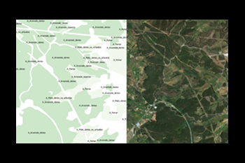
The production of geospatial information for the Military Map relies on the comprehensive acquisition of real‑world objects. Vegetation is one of the key thematic layers, captured through aerial photography and later interpreted and manually vectorized by photogrammetry operators. These operators classify geographic features according to the Acquisition Standards, in a process known as restitution[1].
Given the large volume of information that must be manually processed, combined with the need for field validation and the time gap between aerial photography and ground surveys, the current workflow is both demanding and time‑intensive.
This project aims to develop tools that apply machine learning algorithms to automatically classify permanent vegetation using multispectral Sentinel imagery, in accordance with CIGeoE’s Acquisition Standards. Incorporating this automated process into the Military Map production chain will significantly reduce data acquisition time and improve the timeliness of updates relative to field validation data.
Permanent vegetation, as defined by these standards, includes natural or cultivated vegetation that maintains its coverage throughout seasonal changes, provided no external factors (such as fires or deforestation) significantly alter its extent. Although minor variations may occur over time, the overall characteristics remain relatively stable year‑round, making this type of vegetation particularly suitable for cartographic cataloging.
[1] These standards are confidential and access‑restricted. They were made available solely for the purpose of developing an effective methodology.
